 |
 |
Images of MarriagesImages of Wills and Estates
Roanoke County Probate Records
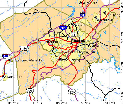 The county, located in the Blue Ridge Mountains, was established during March of 1838 when an Act of the Virginia Legislature took the southern part of Botetourt County. It was named for the Roanoke River. Later, during 1845, additional territory was transferred to Roanoke County from Montgomery County. Salem was originally the county seat until Salem became an independent city and the Roanoke Court House was removed to the Cave Spring District. Ultimately, the Roanoke towns and cities became a district for the territory known as "Roanoke". Adjoining counties are Bedford, Botetourt (which land was transferred into Kentucky), Craig, Floyd, Franklin and Montgomery Counties. Essentially, genealogists with ancestors in the Blue Ridge Mountains should research all of these counties to understand more about where their ancestors resided, or migrated from.
Roanoke County Wills 1838 to 1903
- Kyle, James, continued
- Langhorne, James
- Lavender, C. F.
- Lavender, Thomas
- Lavinder, Elizabeth
- Lawton, Jane
- Ledgerwood, Margaret
- Ledgerwood, Rebecca
- Ledgerwood, William
- Leffler, Joseph
- Lewis, Jane
- Lewis, Maria
- Lewis, Robert Sr.
- Littrell, John
- Logan, Giles
- Logan, James T.
- Logan, John B.
- Logan, Letitia
- Logan, Robert
- Lowry, George
- Loyd, Robert
- Lunsford, Thomas
- Mann, Agnes
- Marks, William P.
- Martin, Fannie M.
- Martin, Robert D.
- Mason, Daniel
- McCantey, John
- McCauley, Susan
- McClanahan, Elijah
- McClanahan, James
- McClanahan, Lucy
- McClung, John B.
- McDonald, Belle
- McFadden, Page
- McHenry, Mary
- Miller, George H.
- Miller, Martin
- Miller, Michael
- Minnix, Lewis
- Mitchell, John F.
- Moore, Emily
- Moore, Joseph
- Moorman, Elvira
- Moorman, John J.
- Moorman, Mark
- Moorman, Philip
- Morgan, D. A.
- Mossman, George
- Murray, Jacob
- Murray, James
- Murry, Catherine
- Muse, Benjamin
- Muse, Charles W.
- Muse, John
- Muse, John Wesley Sr.
- Muse, Joseph M.
- Muse, Sarah
- Myers, David
- Neal, Armstead
- Neal, Owney
- Nelms, Moses
- Newman, Lewis
- Nighdy, George
- Oliver, Carter Bacon
- Oliver, Charles
- Oliver, Charles E.
- Oliver, Lucy
- Owens, David
- Pace, Valentine
- Palmer, James W.
- Parker, James M.
- Parrish, John
- Patterson, Ephraim
- Persinger, Elizabeth E.
- Persinger, Jacob
- Persinger, John
- Persinger, Mary F/
- Persinger, William
- Perkins, Benjamin
- Pettit, William
- Petty, Abner
- Philip, Samuel Sr.
- Poage, Elijah
- Poager, John
- Poager, Margaret
- Powell, Jennie
- Powell, W. P.
- Powers, Henrietta
- Powers, Urias
- Preston, Louisa
- Pritchard, Joseph
- Pritchard, Martha
- Pryor, Nancy
- Pullin, Caroline
- Quarles, Abram
- Ragland, Ellen
- Rayford, Betsy
- Read, Betsey
- Read, Davis
- Renn, Catherine
- Renn, John
- Rettinger, Michael
- Reynolds, Andrew
- Rhodes, Frederick
- Rhodes, William F.
- Richards, David
- Richardson, Lewis W.
- Richardson, Nancy
- Richardson, William
- Riffey, Elizabeth
- Riffey, Thomas
- Riffler, James
- Ripley, Henry
- Roberts, Sue
- Robinson, Thomas
- Ronk, John
- Rouk, William
- Rucker, Lindsay
- Ruddell, Michael
- Ryall, James
- Scott, James H.
- Scott, John
- Scruggs, William Henry
- Sedon, Gustavus
- Sessler, Mark
- Shanks, Susan
- Shartzer, James
- Shaver, Adam
- Sheffey, Malinda
- Shelor, Susanna
- Shiner, John
- Shirey, Elizabeth
- Shootman, Nicholas
- Short, Polly
- Showawalter, Sam
- Simmons, S. F.
- Sims, William
- Sims, William, continued
- Slatter, Jacob
- Slaughter, Cornelia
- Sloan, David
- Smith, A. McD
- Smith, Charles
- Smith, Jacob
- Smith, John
- Smith, John H.
- Snider, Henry
- Snyder, Aron
- Snyder, Charles L.
- Snyder, Christian
- Snyder, P. H.
- Snyder, William T.
- Sorrel, Letitia
- Sovern, Anderson
- Sowers, Emeline
- Spessard, Hezekiah
- Spessard, John
- Spessard, Michael
- Stevens, Charles W.
- Stevens, Jacob
- Stevens, Susan
- Stover, Joseph
- Strickland, M. W.
- Strickler, John
- Sublett, T. C.
- Swartz, Christian
- Taliff, Margaret
- Tarver, George H.
- Tarver, James
- Taylor, George P.
- Terrill, Sarah
- Terry, J. M.
- Thomas, Charles
- Thomas, Elias
- Thomas, Eliza
- Thomas, Marshal
- Thrasher, Frederick
- Thrasher, Mary
- Thrasher, Paul
- Thrasher, Sallie
- Tower, Albert
- Trout, Alexander
- Trout, George
- Trout, Michael
- Tyler, James O.
- Tyree, Cornelius
- Tyree, Ella
- Tyree, Nannie
- Utz, James
- Vanzant, Julia
- Vinyard, Abraham
- Waldrond, Laban
- Walsh, Joseph
- Walter, William Sr.
- Walton, Fanny
- Walton, John
- Walton, Thomas S.
- Walton, William L.
- Watts, Edward
- Watts, William
- Webber, Sallie
- Webster, David
- Webster, Henry L.
- Webster, Henry
- Wenger, Joseph
- Wertz, Christian
- Wertz, Jacob Sr.
- Wertz, John
- Wertz, Peter Sr.
- West, Calvin
- White, C. O.
- White, Mary B.
- Willet, David
- Williams, David
- Williams, Margaret
- Williamson, Stephen H.
- Williamson, William L.
- Withers, John
- Withers, Julia
- Withers, Maria
- Withrow, Joel
- Wolfenden, Augustus
- Wolfenden, Thomas
- Woods, Joseph
- Woods, Joseph and Sarah
- Woolford, Walton
- Wray, Juble
- Wright, Joseph
- Zirkle, Lewis
- Abbott, Andrew
- Abbott, Richard
- Agee, Jubel
- Aisheart, Annie
- Allison, Robert C.
- Anderson, Joseph Alexander
- Armstrong, Edward
- Armstrong, Mary
- Armstrong, Phares
- Baer, Sallie Ann
- Ballard, A. B.
- Bandy, John
- Bandy, Joseph W.
- Bandy, Richard
- Banks, John H.
- Barnett, David
- Barnhart, Davis
- Barnett, Giles
- Barrier, W. A.
- Bass, Mary
- Bazzel, Mary
- Bell, George M.
- Bennett, Mary
- Betts, Sarah
- Board, G. B.
- Board, Martha
- Bolin, James
- Bonsack, Jacob
- Bonsacks, John
- Boon, Godlove
- Boon, Zebulon
- Bradley, Lydia
- Bradshaw, India
- Bramwell, Joseph B.
- Branch, Ann
- Breckinridge, Elizabeth
- Brown, Abram
- Brown, Mary Jane
- Brubaker, Elias
- Brubaker, Henry
- Brunk, Jacob
- Bryant, Reuben
- Bryant, William D.
- Burchett, J. R.
- Burkett, Davis
- Burkett, Mary
- Burnett, Joshua
- Burnett, Sarah
- Burns, Samuel T.
- Burwell, Nathaniel
- Butt, Henry
- Campbell, Clark
- Campbell, James
- Campbell, John
- Campbell, Joseph
- Campbell, Lucy, Mrs.
- Campbell, Mary A.
- Campbell, Randall
- Carney, Charles
- Carney, Susannah
- Carr, George Watson
- Chalmers, James
- Chapman, Henry H.
- Chapman, John S.
- Cirkle, John
- Claiborne, Willie
- Cocke, Charles
- Coffman, David
- Coleman, Virginia
- Coles, Elizabeth
- Collins, Abraham
- Coon, John
- Corley, J. B.
- Corley, Lydia
- Craig, Malinda
- Craig, Robert
- Crawford, James Sr.
- Crawford, Martha J.
- Crawford, Samuel
- Cron, William
- Cron, William R.
- Cumpston, Mary Mitchell
- Custer, Jacob
- Custer, Samuel
- Custer, Susan
- Dandridge, William
- Davis, John T.
- Deaton, Francis
- Deaton, John
- Dent, Harvey J.
- Denton, Phebe
- Deyerle, Charles
- Deyerle, David
- Deyerle, James E.
- Deyerle, Joseph
- Deyerle, Serena
- Dickenson, J. C.
- Dilliard, Alfred
- Dillard, Louisa
- Dingledin, Balser
- Duckwiler, Joseph
- Duckwiler, Salome
- Dyler, Cornelius
- Eakin, Hannah
- Eakins, Hester
- Edington, James
- Edington, John
- Eller, Abraham
- Eller, John Sr.
- Eller, John W.
- Estes, Benjamin
- Evans, Elizabeth
- Evans, Jonathan
- Faris, Benjamin
- Farley, William
- Ferguson, David
- Fischer, Adolph Hugs
- Fishburne, Margaret
- Fowler, Jacob
- Fowler, Thomas
- France, John S.
- France, Madison
- France, Mary
- Francis, John A.
- Francison, Lewis
- Frantz, Ann
- Frantz, Peter
- Frey, John
- Frier, J. B.
- Gaines, Kemp
- Gardner, Virginia
- Garman, Adam
- Garst, Ann C.
- Garst, Frederick
- Garst, George
- Garst, George Sr.
- Garst, Jacob
- Gish, David Sr.
- Gish, Elizabeth
- Gish, George
- Goff, Minerva
- Goff, Nelson
- Goff, Whitfield
- Goin, Norman
- Goins, Sallie F.
- Goldman, Augaletta
- Goode, John H.
- Goodwin, David
- Goolsby, Thomas
- Gordon, Simon
- Graves, W. F., Colonel
- Greass, Jacob
- Green, John W.
- Greenhow, John
- Griffin, John H.
- Grisso, Joel
- Grisso, John
- Ground, George
- Gusonou, Adam
- Hale, Henry
- Hall, William Sr.
- Hannah, James H.
- Hannah, Patterson
- Hannah, Sarah
- Hansbrough, G. W.
- Harlowe, Julia
- Harris, Benjamin
- Harris, Elizabeth
- Harris, John L.
- Hartman, Abraham
- Hartman, George
- Hartman, John
- Hartman, Luke
- Hartman, Mary
- Hartman, Michael
- Harvey, Alford
- Harvey, Francis
- Harvey, Robert
- Hays, Zachariah
- Henderson, Bettie
- Henderson, John A.
- Henry, Samuel W.
- Henry, William
- Holcombe, Anne
- Holcombe, William J.
- Holland, Luther
- Holley, Fannie
- Horner, George Moisley
- Houston, Thomas J.
- Howbert, George
- Howbert, Lydia
- Howbert, Samuel
- Howell, James
- Huff, Harriet D.
- Huff, Harriett
- Huff, James C.
- Huff, Robert
- Huffman, Caleb
- Hunt, John
- Hunter, Thomas
- Hupp, Abraham
- Jack, Edward
- Jack, Fannie
- Jack, Matilda
- Jackson, Andrew
- James, Mary A.
- James, R. B.
- Jeter, Ira
- Jewell, Thomas
- Johns, George D.
- Johnson, David
- Johnson, Lucy J.
- Johnston, Elizabeth
- Johnston, John
- Johnston, Joseph H.
- Johnston, Lucy A.
- Johnston, Margaret
- Jones, Richard
- Karsey, Virginia
- Keagy, Benjamin
- Keaggy, Henry
- Keagy, Elizabeth
- Kefauver, Peter
- Kefauver, Sarah
- Kelly, Sarah
- Kent, Jane
- Kent, John B.
- King, Joseph R.
- Kittinger, John W.
- Kyle, James
Roanoke County Wills 1841 to 1898
Roanoke County Wills 1841 to 1844